
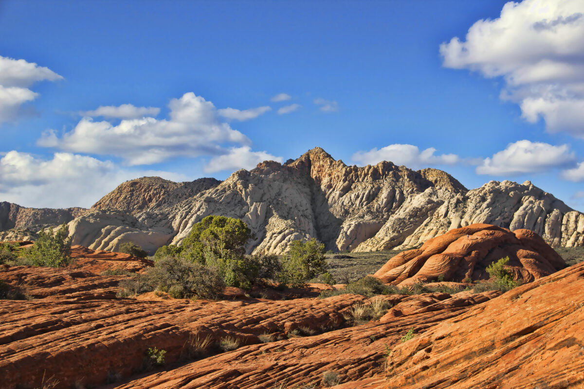
The bluffs and plateaus just outside of Zion National Park are covered in family-friendly trails, photo opportunities, and adventurous scrambles. With a willingness to explore, you might just find your new favorite trail.
Sure, Angels Landing and The Narrows rank most popular for Zion National Park hikes — and for good reason; they’re sensational — but if you miss a permit deadline or just want to explore a quieter path, Greater Zion is filled to the brim with hiking trails inside and outside our 4 state parks — Snow Canyon State Park, Gunlock State Park, Quail Creek State Park and Sand Hollow State Park.
Many areas in Greater Zion are unbridled, which means you have plenty of room to explore. Still, it takes a bit of extra precaution and preparation. Wear shoes or boots with good tread and comfortable, protective clothing. You may find yourself scrambling on sandstone rocks or exploring the mouth of a cave on some of these trails. While exploring is always encouraged, please stay on the trails for your own safety and to protect the natural landscape.
Great Hikes for Families
Make family memories with a hike through the Greater Zion landscape. Spot native desert plants and wildlife along the way. Take in the views of majestic red rock cliffs and the expansive blue sky. Above all, be prepared to hit up our trails with your family. Bring plenty of water, wear protection from the sun that won’t cause you to get too hot, and hike at your own pace. Finally, be aware of your surroundings and stay on the trail – getting turned around in some areas is surprisingly easy
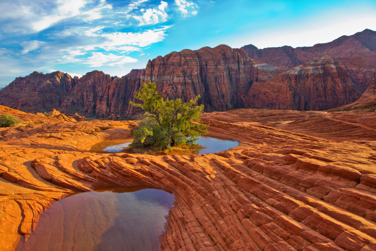
Petrified Dunes Trail
Distance: 0.60 miles
Difficulty: Easy
Elevation Gain: 196 feet
Estimated Time: 20 minutes
Dog Policy: Allowed on leash
Nearest Basecamp: St. George
Best Time to Hike: Year-round
Best Elements: Scrambling, family, views
In the heart of Snow Canyon State Park, you’ll find the Petrified Dunes Trail. Once flowing sand mountains, these mounds of petrified Navajo sandstone are a family favorite for scrambling. A short trail leads to the dunes, but once you arrive, there’s no established trail, leaving you to explore responsibly. It’s only a half-mile, but the dunes rise more than 300 feet above the canyon floor. Climb the natural stairs to the top or venture out to an overlook to enjoy the views below and beyond.
Consider planning your hike early in the morning or later in the evening, as there is little to no shade, and bring plenty of water and sun protection.
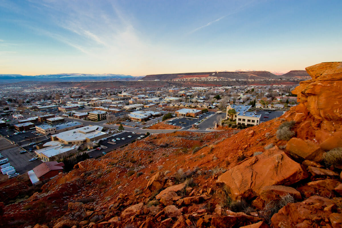
Temple Quarry Trail
Distance: 2.3 miles
Difficulty: Easy
Elevation Gain: 131 feet
Estimated Time: 1 hour
Dog Policy: Allowed on leash
Nearest Basecamp: St. George
Best Time to Hike: Year-round
Best Elements: Accessibility, city views
Temple Quarry Trail is a short, relatively easy, historical, out-and-back trail suitable for all ages. The trail is mostly flat, with a few stairs at the beginning. It’s a great option if you don’t have much time or you’re hiking with children but still want to take in spectacular views.
This hike takes about an hour to complete and is best hiked during spring, fall, and winter to avoid the high heat of the desert.
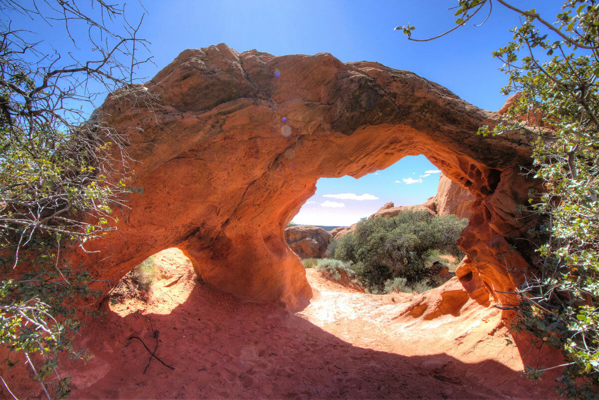
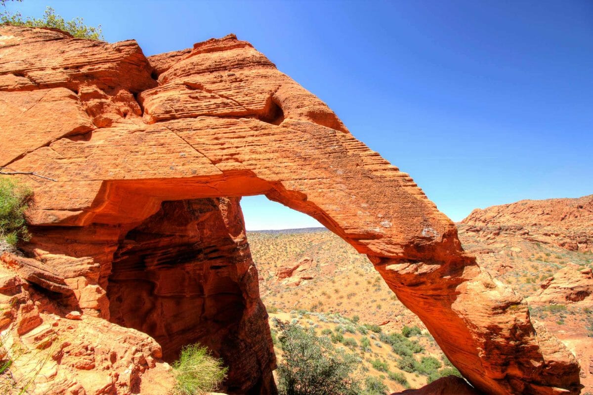
Babylon Arch Trail
Distance: 1.5 miles
Difficulty: Moderate
Elevation Gain: 259 feet
Estimated Time: 1 hour
Dog Policy: Allowed on leash
Nearest Basecamp: Hurricane
Best Time to Hike: Year-round
Best Elements: Arch, family
The sandy Babylon Arch Trail is in the Red Cliffs Desert Reserve. This moderately challenging hike has a few steep, sandy descents and one steep climb, but the views are worth it. Set amongst other red rock formations, you can walk through the arch and explore the beautiful area. Continue a bit farther for views of the Virgin River winding through the desert landscape.
If hiking in summer, get started early and bring water, sunscreen, and sun-protective clothing because temperatures can rise well above 100 in the afternoon.
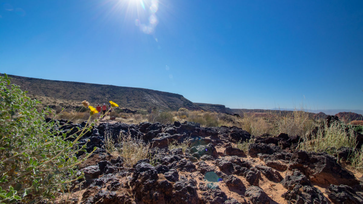
Lava Flow Trail
Distance: 2.5 miles
Difficulty: Easy
Elevation Gain: 416 feet
Estimated Time: 1-2 hours
Dog Policy: Allowed on leash
Nearest Basecamp: St. George
Best Time to Hike: Year-round
Best Elements: Lava tubes, views, geology
Lava Flow Trail is an easy trail that takes you through a black lava field and past a couple of lava tubes to an overlook with incredible views of the whole area. The trail is 2.5 miles roundtrip and takes 1 to 2 hours to complete depending on how long you spend exploring the lava tubes. Many consider this one of the best hikes in Snow Canyon State Park with a hard-packed path and multiple lava tubes to explore.
It’s possible to travel 50 feet into the lava tubes, but if you’re going to, be sure you have a powerful headlamp and explore safely. The trail ends with a 100-foot-high, pyramid-shaped slickrock hill, and from this mini-summit, you’ll get a fantastic view of the whole park.
The trail is quite rocky, so wear hiking shoes with closed toes and good traction.
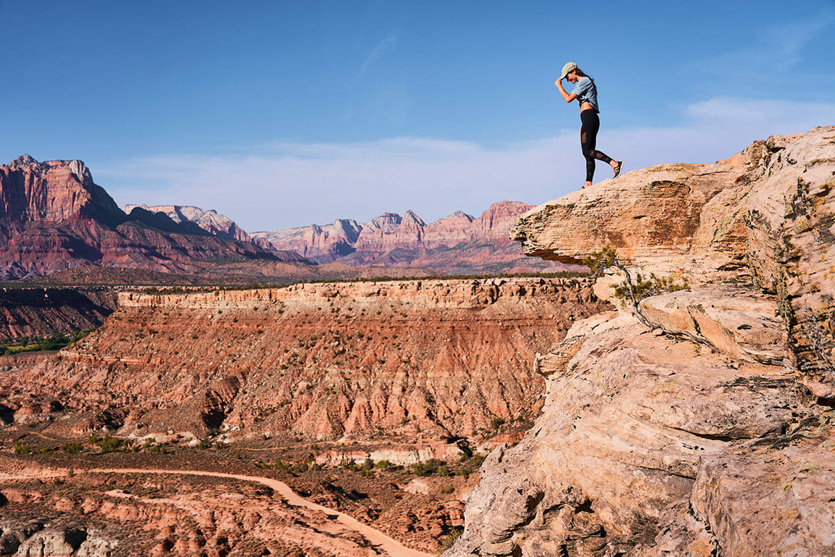
Hikes With Unforgettable Views
It’s important to document your adventures. We’d love you to have plenty of great photos on which to reflect and relive your Greater Zion experience. However, we ask that you be considerate of others on the trail and take only photos with you. Hiking is one of the greatest disconnects from day-to-day life, and it’s up to all of us to foster that environment. Respect your fellow hikers; leave the trail better than you found it, so we can enjoy this Land of Forever.
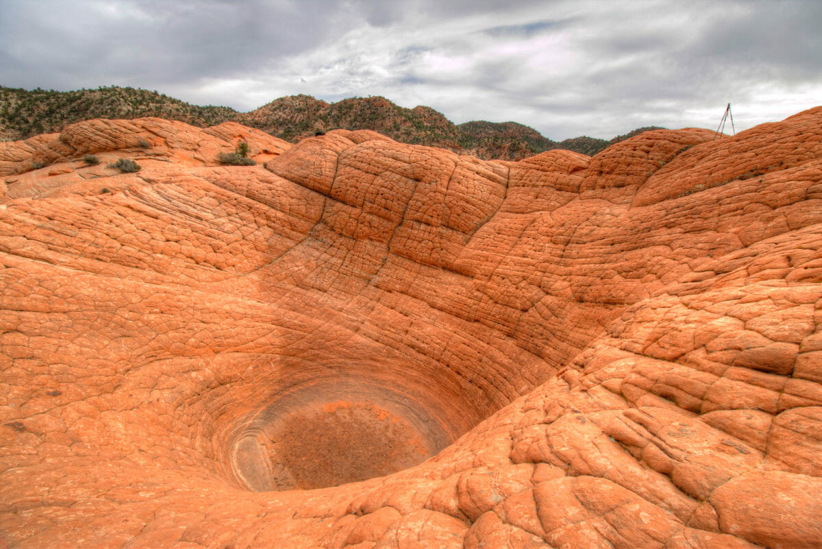
The Vortex (aka The Bowl)
Distance: 2.3 miles
Difficulty: Moderate
Elevation Gain: 400 feet
Estimated Time: 1 hour
Dog Policy: Allowed on leash
Nearest Basecamp: Gunlock
Best Time to Hike: Year-round
Best Elements: Landmarks, scrambling
This unique trail is a short, moderately difficult hike up a rolling formation of sandstone set among high-desert scrub. The views are enjoyable throughout, with plenty of intriguing rock formations. The trail’s main feature is a large sunken hole/pit set high on the rock formation. Once you see it, you’ll understand the name. It looks exactly like a perfect bowl or swirling vortex. Take in Gunlock State Park and Reservoir views and the surrounding landscape from this spot.
Snow Canyon Overlook
Distance: 4.8 miles
Difficulty: Moderate
Elevation Gain: 356 feet
Estimated Time: 2 hours
Dog Policy: Allowed on leash
Nearest Basecamp: Veyo
Best Time to Hike: Year-round
Best Elements: Views, geological variety, elevation
Snow Canyon Overlook spurs off Red Mountain Trail and leads you to one of Southern Utah’s best viewpoints. It’s a moderate hike up high desert terrain that starts rocky, but smooths out about a half-mile up. While there isn’t much to the trail, once you reach the destination (a drop-off of nearly 1,000 feet to the bottom of Snow Canyon), the hike will be well worth it. You can see the vast scope of the Utah desert from the overlook. Set up a picnic, take photos, and enjoy the incredible scenery.
Yant Flat (aka Candy Cliffs)
Distance: 2.46 miles
Difficulty: Easy
Elevation Gain: 182 feet
Estimated Time: 1.5 hours
Dog Policy: Allowed on leash
Nearest Basecamp: Leeds
Best Time to Hike: Summer, Fall
Best Elements: Views, scrambling, family
Yant Flat, or Candy Cliffs, has views of geological formations you won’t find anywhere else. You’ll see candy-like sandstone formations, the white cliffs of Zion, Sand Hollow Reservoir, and rolling acres of red-marbled sandstone. It’s truly one of the best trails near St. George. The trail is anywhere from 2.5 to 7 miles long, depending on how much you want to explore, and takes around two to five hours to complete.
This lightly used out-and-back trail is best explored between October and April.
Scout Cave
Distance: 2.8 miles
Difficulty: Easy
Elevation Gain: 231 feet
Estimated Time: 2 hours
Dog Policy: Allowed on leash
Nearest Basecamp: Ivins
Best Time to Hike: Year-round
Best Elements: Cave, family
Looking for a fun hike that the whole family will enjoy? Check out Scout Cave via the Johnson Canyon Trail or Chuckwalla Trailhead. This huge, red cave is a crowd pleaser for hikers of any age. Both trails are well-marked but relatively rocky, so ensure everyone wears hiking shoes or boots.
If you take Johnson Canyon Trail, you’ll pass through a wash beneath two caves farther up the hillside. At this point, you’ll climb at least four flights of stairs and then find the path that goes directly to the caves. Scout Cave is the cave on the left and offers views back into Snow Canyon.
For more of a challenge, take the route via Chuckwalla Trailhead – using North Crossing, Paradise Rim, and onto the Scout Cave Trail. This is moderately strenuous due to the steep and rocky descent. Make sure to pack plenty of water and sun protection, as there is little shade on this hike.
Elephant Arch
Distance: 3.8 miles
Difficulty: Moderate
Elevation Gain: 200 feet
Estimated Time: 2 hours
Dog Policy: Allowed on leash
Nearest Basecamp: Washington
Best Time to Hike: Year-round
Best Elements: Arch, family
Elephant Arch is a beautiful arch high in the red rocks of the Red Cliffs Desert Reserve. The trail is located north of Washington City and is used by hikers and horses to reach the arch that looks like an elephant’s head and trunk. It can be hard to find from the trailhead, so be prepared with a map.
The first half of the 3.8-mile trail is on a dirt road, but the rest is extremely sandy, which can be more physically taxing. Enjoy views of beautiful wildflowers and Navajo sandstone hills as you climb every sandy step!
Although the desert seems like rugged, tough terrain, many fragile ecosystems exist here. As you enjoy these trails, please do your best to stay on the trail. The surrounding foliage and cryptobiotic soil are crucial to keeping these landscapes healthy.
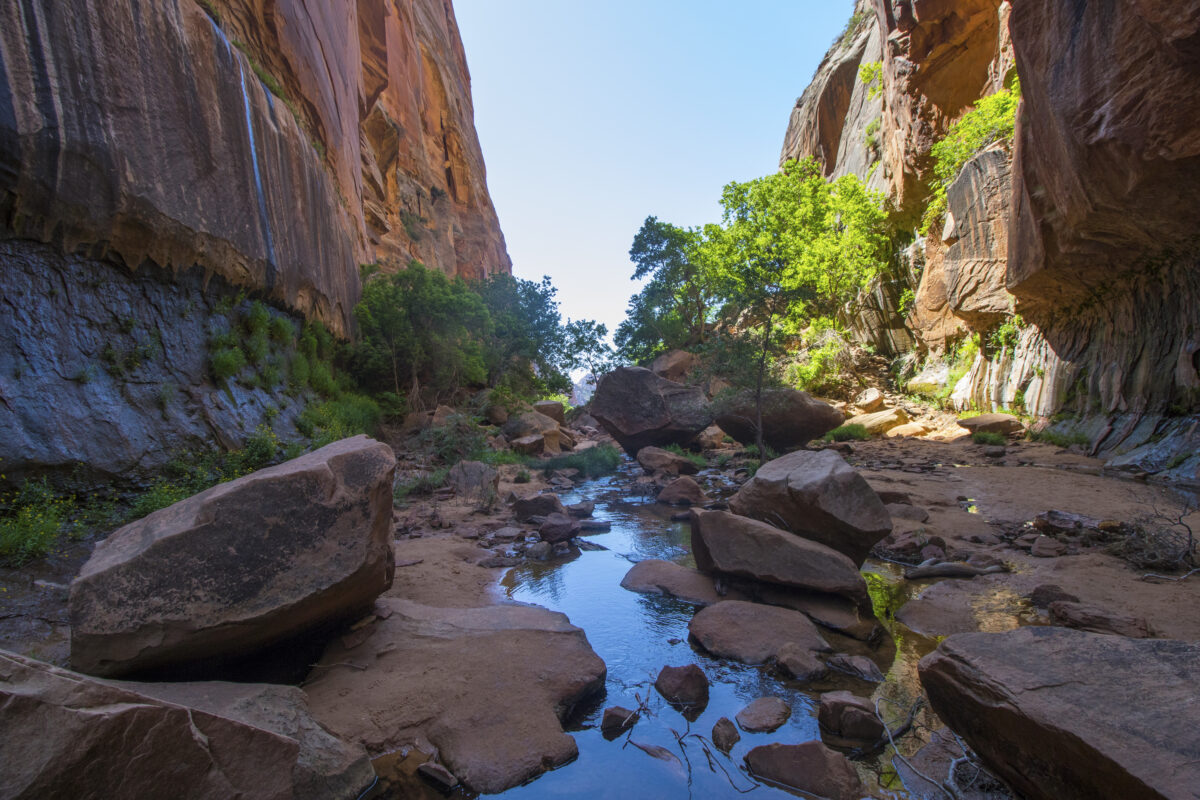
Water Canyon
Distance: 3.2 miles
Difficulty: Moderate
Elevation Gain: 2,029 feet
Estimated Time: 3 hours
Dog Policy: Allowed
Nearest Basecamp: Hurricane
Best Time to Hike: Summer, Fall
Best Elements: Water, views
This hike offers incredible views and scenery that will leave you feeling like you’re at Zion National Park rather than just in its backyard. It starts as a sandy trail along the creek, going up a vast canyon.
As you head up the trail and climb higher, the canyon walls will quickly start to narrow in and tower above you. As you get closer to the canyon’s end, you’ll see a sandstone arch forming on the cliff’s top edge. Shady trees and a small, beautiful waterfall are at the canyon’s end. It’s a great place to have a snack and relax at the end of your journey! Canyoneering options exist to go farther into and up the canyon for those with proper equipment and know-how.
Hikes for the Adventurous
Gooseberry Mesa
Distance: 11.5 miles
Difficulty: Difficult
Elevation Gain: 725 feet
Estimated Time: 4 hours
Dog Policy: Allowed on leash
Nearest Basecamp: Hurricane
Best Time to Hike: Spring, Fall
Best Elements: Views, mountain biking
Popular for mountain biking, hiking, and birding, Gooseberry Mesa Trail is a difficult 11.4-mile loop with lots of short and steep sections throughout. It takes four to five hours to complete, depending on how you use the trail. This is one of the most popular mountain biking trails in the world. Reach the views on the backside of the loop, and you’ll know why.
Visit any time of year, but avoid the hottest summer months for the best experience. Sturdy footwear is especially important here, as the punchy climbs and descents along the way add to the difficulty of an already lengthy trail.
Whipple Trail
Distance: 10.5 miles
Difficulty: Difficult
Elevation Gain: 2,800 feet
Estimated Time: 5.5 hours
Dog Policy: Allowed on leash
Nearest Basecamp: Pine Valley, Veyo
Best Time to Hike: Summer
Best Elements: Forest, rivers, views
Enjoy a moderately challenging 10.6-mile, out-and-back trail near Pine Valley that’s full of wildlife viewing opportunities and stunning vistas. This hike takes around six hours to complete, and is best visited from March to October.
It’s a popular trail, but you can enjoy more tranquility early in the morning, late in the evening, or on weekdays. Be sure to pay close attention to follow the trail as there are quite a few switchbacks on the climb.